South Corvallis: Difference between revisions
From Wildsong
Jump to navigationJump to search
Brian Wilson (talk | contribs) |
Brian Wilson (talk | contribs) |
||
| Line 3: | Line 3: | ||
== What is South Corvallis? == | == What is South Corvallis? == | ||
GIS data courtesy of [http:// | GIS data courtesy of [http://www.ci.corvallis.or.us/index.php?option=content&task=view&id=525&Itemid=464 City of Corvallis GIS services], if you want information on your property check their [http://corvallismaps.com/ Corvallis Maps] page. | ||
Maps courtesy of Brian Wilson at [http://www.AlseaGeo.com Alsea Geospatial, Inc] | Maps courtesy of Brian Wilson at [http://www.AlseaGeo.com Alsea Geospatial, Inc] | ||
Revision as of 19:25, 6 March 2009
What is South Corvallis?
GIS data courtesy of City of Corvallis GIS services, if you want information on your property check their Corvallis Maps page.
Maps courtesy of Brian Wilson at Alsea Geospatial, Inc
As a neighborhood
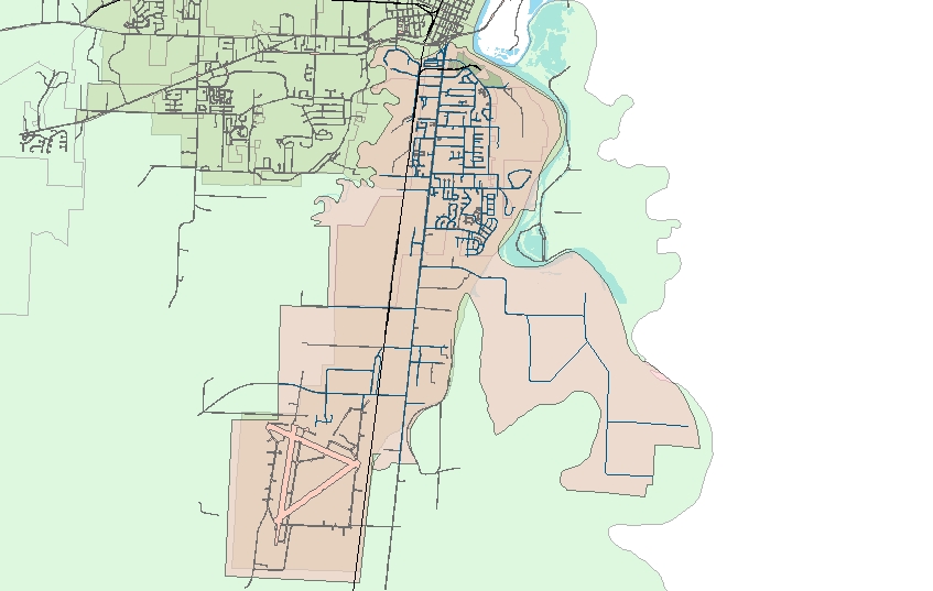
This map shows an extent including everything between the Marys and Willamette Rivers. As a neighborhood, this is my idea.
As a political area
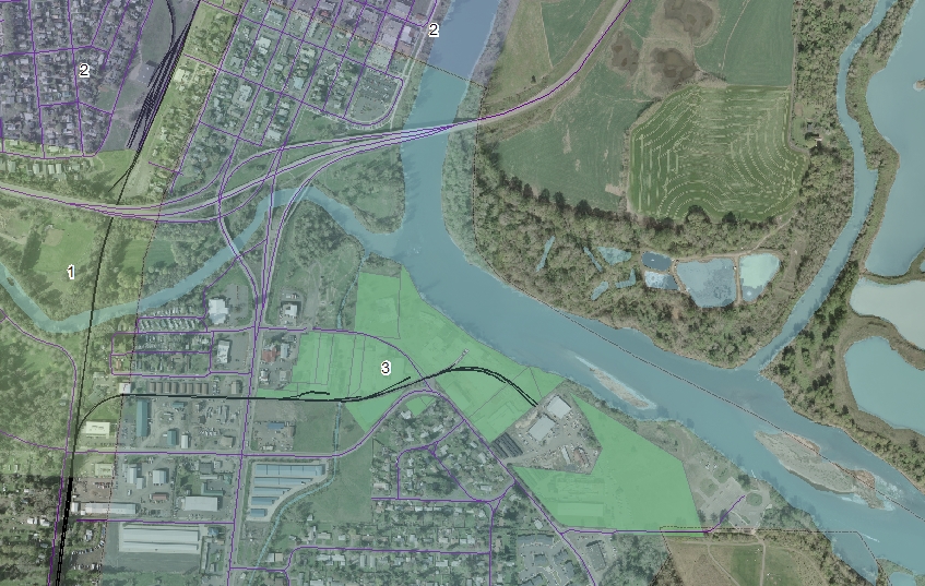
This detail map shows how Ward 3 extends north of the river as far as 1/2 block north of Western Ave. It also shows the Evanite facility highlighted as a green zone.

