South Corvallis: Difference between revisions
From Wildsong
Jump to navigationJump to search
Brian Wilson (talk | contribs) mNo edit summary |
Brian Wilson (talk | contribs) mNo edit summary |
||
| Line 1: | Line 1: | ||
[[Category:Maps]] | [[Category:Maps]] | ||
== What is South Corvallis? == | |||
''All data courtesy [http://corvallismaps.com/ City of Corvallis], | |||
Maps courtesy of Brian Wilson at [http://www.AlseaGeo.com Alsea Geospatial, Inc]'' | |||
=== As a neighborhood === | |||
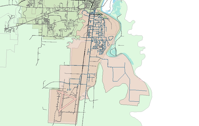
This map shows an extent including everything between the Marys and Willamette Rivers. As a neighborhood, this is my idea. | |||
[[Image:OR_SouthCorvallis.jpg]] | [[Image:OR_SouthCorvallis.jpg]] | ||
=== As a political area === | |||
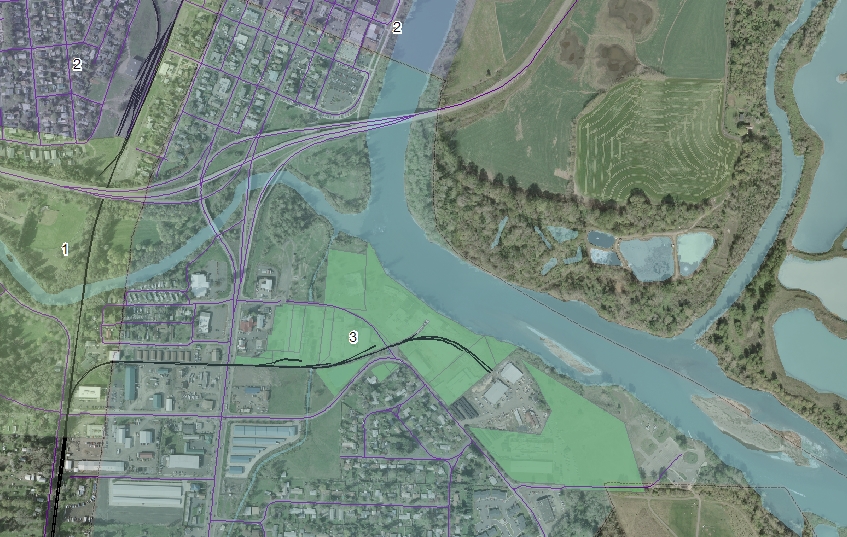
This detail map shows how Ward 3 extends north of the river as far as 1/2 block north of Western Ave. It also shows the Evanite facility highlighted as a green zone. | |||
[[Image:OR_SouthCorvallis_EVANITE.jpg]] | |||
Revision as of 19:21, 6 March 2009
What is South Corvallis?
All data courtesy City of Corvallis, Maps courtesy of Brian Wilson at Alsea Geospatial, Inc
As a neighborhood
This map shows an extent including everything between the Marys and Willamette Rivers. As a neighborhood, this is my idea.
As a political area
This detail map shows how Ward 3 extends north of the river as far as 1/2 block north of Western Ave. It also shows the Evanite facility highlighted as a green zone.

